Ball has also stated that "for 32 years I was a Professor of Climatology at the University of Winnipeg.]
Ball's resume shows that at the University of Winnipeg he was Associate Professor from 1984 to 1988, then Professor from 1988 to 1996, a total of 8 years.
Our cooling world
- Thread starter Walter
- Start date
You are using an out of date browser. It may not display this or other websites correctly.
You should upgrade or use an alternative browser.
You should upgrade or use an alternative browser.
Oops, sorry to rain on your parade of the stupid Walt.:lol:
Btw, nice avatar, I always knew you were a racist.:roll:
Btw, nice avatar, I always knew you were a racist.:roll:
Really, you guys. Using regional examples of cooling or warming is not really relevant. We are discussing global warming here. That means the overall temperature of Earth, not Antartica or Jebel Jais or wherever.
Lookit here:

That's from GISS.
I don't care which country you get the research from, they all have similar data. The data shows a general trend of GLOBAL temperature rising. "Oh, but we had the coldest winter on record here in Podunk". :roll:
Lookit here:
That's from GISS.
I don't care which country you get the research from, they all have similar data. The data shows a general trend of GLOBAL temperature rising. "Oh, but we had the coldest winter on record here in Podunk". :roll:
Really, you guys. Using regional examples of cooling or warming is not really relevant. We are discussing global warming here. That means the overall temperature of Earth, not Antartica or Jebel Jais or wherever.
Lookit here:
That's from GISS.
I don't care which country you get the research from, they all have similar data. The data shows a general trend of GLOBAL temperature rising. "Oh, but we had the coldest winter on record here in Podunk". :roll:
Climate change is the key, is increased precipitation the norm for Canada resulting in more snow?
Of course climate change is a key, after all it IS the topic, right?
I have no idea if Canada is getting more precip but I am just wondering what precip in Canada has to do with what my point was.
I have no idea if Canada is getting more precip but I am just wondering what precip in Canada has to do with what my point was.
I was raptly watching E. May on a television interview the other night.
There was one point she insisted on making over and over.
It's not to be called global warming anymore.
No more talk of global warming....ever.
Henceforth it is to be called Climate Change.
No more mention of global warming.......just Climate Change.
I like it.
Global warming was an "all your eggs in one basket" kind of label.
Tough to spin through record breaking cold snaps.
Some of the data trends looked like they could go either way.
Time to open another front so to speak.
Climate Change is so all encompassing.
Impossible to get in a box.
Any and all data is up for grabs.
After all, Climate Change is exactly whatever you say it is.
Donate to Climate Change.
Support preventing Climate Change.
Fund the slowing of Climate Change.
This one has legs.
Trex
Of course climate change is a key, after all it IS the topic, right?
I have no idea if Canada is getting more precip but I am just wondering what precip in Canada has to do with what my point was.
Added comentary for the deniers who think a cold day means Al Gore is full of it.
Thats all.
Btw, nice to see you climbed aboard the obvious.
You mean that climate changes? It isn't so much that I climbed aboard it as much as it's dragging me along with it the same as everyone else.Added comentary for the deniers who think a cold day means Al Gore is full of it.
Thats all.
Btw, nice to see you climbed aboard the obvious.
You mean that climate changes? It isn't so much that I climbed aboard it as much as it's dragging me along with it the same as everyone else.
What does that mean?
Avro are you deliberately being obtuse?
It means I didn't hop aboard climate change, it happens around me. Same as everyone else and no-one can do anything about it.
It means I didn't hop aboard climate change, it happens around me. Same as everyone else and no-one can do anything about it.
Global warming's no longer happening
So why are eco types moaning about record highs while ignoring record lows?
By Lorne Gunter, The Edmonton JournalMarch 15, 2009 3:02 AM
So far this month, at least 14 major weather stations in Alberta have recorded their lowest-ever March temperatures. I'm not talking about daily records; I mean they've recorded the lowest temperatures they've ever seen in the entire month of March since temperatures began being recorded in Alberta in the 1880s.
This past Tuesday, Edmonton International Airport reported an overnight low of -41.5 C, smashing the previous March low of -29.4 C set in 1975. Records just don't fall by that much, but the airport's did. Records are usually broken fractions of degrees. The International's was exceeded by 12 degrees.
To give you an example of how huge is the difference between the old record and the new, if Edmonton were to exceed its highest-ever summer temperature by the same amount, the high here some July day would have to reach 50 C. That's a Saudi Arabia-like temperature.
Also on the same day, Lloydminster hit -35.2 C, breaking its old March record of -29.2 C. Fort McMurray -- where they know cold -- broke a record set in 1950 with a reading of -39.9C. And Cold Lake, Slave Lake, Whitecourt, Peace River, High Level, Jasper and Banff, and a handful of other communities obliterated old cold values, most from the 1950s or 1970s, two of the coldest decades on record in the province.
This has been an especially cold winter across the country, with values returning to levels not often seen since the 1970s, which was an especially brutal decade of winters.
Temperatures began to plummet on the Prairies in December. The cold weather did not hit much of the rest of the country until January, but when it hit, it hit hard. Even against Canada's normally frigid January standards, "this particular cold snap is noteworthy," Environment Canada meteorologist Geoff Coulson said this past January. Many regions across the country had not been as cold for 30 years or more, he added.
Does this prove fear of global warming is misplaced? On its own, probably not. But if records were being broken the other way -- if several Alberta centres had recorded their warmest-ever March values -- you can bet there would be no end of hand-wringing, horror stories about how we were on the precipice of an ecological disaster of unprecedented proportions.
Environmentalists, scientists who advance the warming theory, politicians and reporters never shy away from hyping those weather stories that support their beliefs. But they tend to ignore or explain away stories that might cast doubt.
In 2005, the summer and fall of hurricanes Katrina and Rita, when several major 'canes pummelled North and Central America, we were told again and again that this was proof warming was happening and it was going to be bad. Al Gore has emissions from industrial smokestacks swirling up into a satellite image of a hurricane on the DVD box for his propaganda film An Inconvenient Truth to underline the point that more and eviller hurricanes will be the result of CO2 output.
But since 2005, only one major hurricane -- this year's Ike -- has struck North America. And now comes a study from Florida State University researcher Ryan Maue, that shows worldwide cyclonic activity -- typhoons, as well as hurricanes -- has reached a 30-year low (tinyurl.com/bunynz).
Indeed, the hiatus may go back more than 30 years because it is difficult to compare records before about 1970 with those since, since measurements four or more decades ago were not as precise or thorough. Current low activity may actually be the lowest in 50 years or more.
If Maue had proven hurricane activity were at a 30-year high, of course his findings would have been reported far and wide. But since he is challenging the dogma of the Holy Mother Church of Climate Change, his research is ignored.
For at least the past five or six years, global temperatures have been falling. Look at the black trend line on the chart at Latest Global Temperatures « Roy Spencer, Ph. D. put out by the man who runs NASA's worldwide network of weather satellites.
Also, in the past few months, two studies -- one by the Leibniz Institute of Marine Science and the Max Planck Institute of Meteorology in Germany and another by the University of Wisconsin -- have shown a slowing, or even a reversal of warming for at least the next 10 to 20, and perhaps longer.
Even the Arctic sea ice, which has replaced hurricanes as the alarm of the moment ever since hurricanes ceased to threaten, has grown this winter to an extent not seen since around 1980.
Global warming is not only no longer happening, it is not likely to resume until 2025 or later, if then. So why are we continuing to hear so much doomsaying about climate change?
There are a lot of people in every age who think they know better than everyone else and, therefore, have a right to tell everyone how to live. In the 1950s, it was country-club and parish council busybodies with their strict moral codes. In the 1970s, it was social democrats with their fanciful economic theories. Today, it's environmentalists.
Same instinct, different wrapper.
Global warming's no longer happening
So why are eco types moaning about record highs while ignoring record lows?
By Lorne Gunter, The Edmonton JournalMarch 15, 2009 3:02 AM
So far this month, at least 14 major weather stations in Alberta have recorded their lowest-ever March temperatures. I'm not talking about daily records; I mean they've recorded the lowest temperatures they've ever seen in the entire month of March since temperatures began being recorded in Alberta in the 1880s.
This past Tuesday, Edmonton International Airport reported an overnight low of -41.5 C, smashing the previous March low of -29.4 C set in 1975. Records just don't fall by that much, but the airport's did. Records are usually broken fractions of degrees. The International's was exceeded by 12 degrees.
To give you an example of how huge is the difference between the old record and the new, if Edmonton were to exceed its highest-ever summer temperature by the same amount, the high here some July day would have to reach 50 C. That's a Saudi Arabia-like temperature.
Also on the same day, Lloydminster hit -35.2 C, breaking its old March record of -29.2 C. Fort McMurray -- where they know cold -- broke a record set in 1950 with a reading of -39.9C. And Cold Lake, Slave Lake, Whitecourt, Peace River, High Level, Jasper and Banff, and a handful of other communities obliterated old cold values, most from the 1950s or 1970s, two of the coldest decades on record in the province.
This has been an especially cold winter across the country, with values returning to levels not often seen since the 1970s, which was an especially brutal decade of winters.
Temperatures began to plummet on the Prairies in December. The cold weather did not hit much of the rest of the country until January, but when it hit, it hit hard. Even against Canada's normally frigid January standards, "this particular cold snap is noteworthy," Environment Canada meteorologist Geoff Coulson said this past January. Many regions across the country had not been as cold for 30 years or more, he added.
Does this prove fear of global warming is misplaced? On its own, probably not. But if records were being broken the other way -- if several Alberta centres had recorded their warmest-ever March values -- you can bet there would be no end of hand-wringing, horror stories about how we were on the precipice of an ecological disaster of unprecedented proportions.
Environmentalists, scientists who advance the warming theory, politicians and reporters never shy away from hyping those weather stories that support their beliefs. But they tend to ignore or explain away stories that might cast doubt.
In 2005, the summer and fall of hurricanes Katrina and Rita, when several major 'canes pummelled North and Central America, we were told again and again that this was proof warming was happening and it was going to be bad. Al Gore has emissions from industrial smokestacks swirling up into a satellite image of a hurricane on the DVD box for his propaganda film An Inconvenient Truth to underline the point that more and eviller hurricanes will be the result of CO2 output.
But since 2005, only one major hurricane -- this year's Ike -- has struck North America. And now comes a study from Florida State University researcher Ryan Maue, that shows worldwide cyclonic activity -- typhoons, as well as hurricanes -- has reached a 30-year low (tinyurl.com/bunynz).
Indeed, the hiatus may go back more than 30 years because it is difficult to compare records before about 1970 with those since, since measurements four or more decades ago were not as precise or thorough. Current low activity may actually be the lowest in 50 years or more.
If Maue had proven hurricane activity were at a 30-year high, of course his findings would have been reported far and wide. But since he is challenging the dogma of the Holy Mother Church of Climate Change, his research is ignored.
For at least the past five or six years, global temperatures have been falling. Look at the black trend line on the chart at Latest Global Temperatures « Roy Spencer, Ph. D. put out by the man who runs NASA's worldwide network of weather satellites.
Also, in the past few months, two studies -- one by the Leibniz Institute of Marine Science and the Max Planck Institute of Meteorology in Germany and another by the University of Wisconsin -- have shown a slowing, or even a reversal of warming for at least the next 10 to 20, and perhaps longer.
Even the Arctic sea ice, which has replaced hurricanes as the alarm of the moment ever since hurricanes ceased to threaten, has grown this winter to an extent not seen since around 1980.
Global warming is not only no longer happening, it is not likely to resume until 2025 or later, if then. So why are we continuing to hear so much doomsaying about climate change?
There are a lot of people in every age who think they know better than everyone else and, therefore, have a right to tell everyone how to live. In the 1950s, it was country-club and parish council busybodies with their strict moral codes. In the 1970s, it was social democrats with their fanciful economic theories. Today, it's environmentalists.
Same instinct, different wrapper.
Yep, while man's activities may be largely detrimental, I think they are a drop in the bucket when compared to Mother Nature's management of the world.
Blame sunspots for cool winter, spring weather
By George Taylor
Brrrr! It’s been a cold week, in a cold month, in a cold winter. And it shows no sign of letting up.
Last week the Northwest was gripped by unseasonably cold weather. Areas west of the Cascades saw temperatures dip into the 20s. Locally we dropped as low as 27 on the 13th. Eugene was even colder (24 on the 11th). Two days later, Eugene’s 25 degree-low broke the daily record (26) set in 1944.
So far in March our local Hyslop Experiment Station has seen nine days with lows of 32 or below. The month of March averages 5.7 days, so we’re already well ahead of average for an entire March.
As cold as it was here, the Cascades generally protected us from the coldest Arctic air, which remained mostly north and east of us. On the 11th, Spokane, Wash., reported a low of 2 degrees. This was the latest date for a temperature of 2 degrees or less. The previous latest date occurred March 6, 1891. Sandpoint, Idaho, set a similar record the same day with a reading of -4 degrees, the latest date for a temperature that low.
Western Montana saw temperatures as low as -14, and subzero readings were reported in other states. In Oregon, many daily records were set, many far below the previous. Meacham was -11 on the 11th; the record for was 7, so this week’s weather broke the record by 18 degrees! LaGrande, Pendleton, Moro, The Dalles, Bend, Redmond, and others also set new records.
The cause of this cold month and cold year? Two things: the tropical Pacific and the sun.
The tropical Pacific continues in its “La Nina” mode, in which ocean temperatures off South America are cooler than average. During such conditions, winters in the Northwest are cooler than average, wetter than average, or both. Snowpacks tend to be average or deeper. Thus far, we’ve had a cold but dry winter, with and average mountain snowpack.
The sun continues in its “solar minimum.” There is an 11-year cycle (about) in sunspots. When spots are plentiful, the sun’s energy is stronger, and there is a tendency for Earth’s temperatures to increase. During the low point there are few sunspots, and temperatures are more likely to drop. We have been in a solar minimum for more than a year. NASA and other agencies predicted that sunspot numbers would be increasing by now, but they are not. According to NASA, we are seeing:
• The lowest sustained solar radio flux since the F10.7 proxy was created in 1947;
• Solar wind is the lowest observed since the beginning of the space age;
• The solar wind magnetic field 36 percent weaker than during the minimum of Solar Cycle 23;
• Effectively no sunspots;
• Cosmic rays at near record-high levels.
These might make sense, but here’s what it means: The sun is quiet, and has been for an unusually long period.
Looking back over the last several hundred years, we see that solar output has been high for the last 60 years; this coincided with a general increase in temperatures. There have been some periods with low sunspot counts for many years. The early 1700s and 1800s saw lengthy solar minima, accompanied by cold temperatures.
Some solar physicists are suggesting the minimum is a harbinger of lower sunspot numbers for the next several decades. That would mean lower air temperatures, in general — global cooling!
Others suggest El Nino and La Nina conditions are driven by variations in the sun; periods with low solar output would bring La Nina conditions (such as now). We’ll see. But with a quiet sun and a continuing La Nina, I don’t expect temperatures to warm up much in the near future. Expect a cool spring, like last year.
George Taylor retired as State Climatologist last year and now operates Applied Climate Services of Corvallis. He can be reached at taylorgh@comcast.net.
I did not realize until this post that you were(are) an American! I wondered why anyone would think those temps. were "cool or even cold". It is 8 degrees here but that is Celsius so it really sounds cold. It is chilly but the sun is trying hard to come out. We have had a colder than usual winter and probably the most snowy year on record. However, even with the amount of snow we've had, it's very dry. Along with the sun today, it has also been a constant drizzle of rain until the sun came out. It's a strange year.Blame sunspots for cool winter, spring weather
By George Taylor
Brrrr! It’s been a cold week, in a cold month, in a cold winter. And it shows no sign of letting up.
Last week the Northwest was gripped by unseasonably cold weather. Areas west of the Cascades saw temperatures dip into the 20s. Locally we dropped as low as 27 on the 13th. Eugene was even colder (24 on the 11th). Two days later, Eugene’s 25 degree-low broke the daily record (26) set in 1944.
So far in March our local Hyslop Experiment Station has seen nine days with lows of 32 or below. The month of March averages 5.7 days, so we’re already well ahead of average for an entire March.
As cold as it was here, the Cascades generally protected us from the coldest Arctic air, which remained mostly north and east of us. On the 11th, Spokane, Wash., reported a low of 2 degrees. This was the latest date for a temperature of 2 degrees or less. The previous latest date occurred March 6, 1891. Sandpoint, Idaho, set a similar record the same day with a reading of -4 degrees, the latest date for a temperature that low.
Western Montana saw temperatures as low as -14, and subzero readings were reported in other states. In Oregon, many daily records were set, many far below the previous. Meacham was -11 on the 11th; the record for was 7, so this week’s weather broke the record by 18 degrees! LaGrande, Pendleton, Moro, The Dalles, Bend, Redmond, and others also set new records.
The cause of this cold month and cold year? Two things: the tropical Pacific and the sun.
The tropical Pacific continues in its “La Nina” mode, in which ocean temperatures off South America are cooler than average. During such conditions, winters in the Northwest are cooler than average, wetter than average, or both. Snowpacks tend to be average or deeper. Thus far, we’ve had a cold but dry winter, with and average mountain snowpack.
The sun continues in its “solar minimum.” There is an 11-year cycle (about) in sunspots. When spots are plentiful, the sun’s energy is stronger, and there is a tendency for Earth’s temperatures to increase. During the low point there are few sunspots, and temperatures are more likely to drop. We have been in a solar minimum for more than a year. NASA and other agencies predicted that sunspot numbers would be increasing by now, but they are not. According to NASA, we are seeing:
• The lowest sustained solar radio flux since the F10.7 proxy was created in 1947;
• Solar wind is the lowest observed since the beginning of the space age;
• The solar wind magnetic field 36 percent weaker than during the minimum of Solar Cycle 23;
• Effectively no sunspots;
• Cosmic rays at near record-high levels.
These might make sense, but here’s what it means: The sun is quiet, and has been for an unusually long period.
Looking back over the last several hundred years, we see that solar output has been high for the last 60 years; this coincided with a general increase in temperatures. There have been some periods with low sunspot counts for many years. The early 1700s and 1800s saw lengthy solar minima, accompanied by cold temperatures.
Some solar physicists are suggesting the minimum is a harbinger of lower sunspot numbers for the next several decades. That would mean lower air temperatures, in general — global cooling!
Others suggest El Nino and La Nina conditions are driven by variations in the sun; periods with low solar output would bring La Nina conditions (such as now). We’ll see. But with a quiet sun and a continuing La Nina, I don’t expect temperatures to warm up much in the near future. Expect a cool spring, like last year.
George Taylor retired as State Climatologist last year and now operates Applied Climate Services of Corvallis. He can be reached at [EMAIL="taylorgh@comcast.net."]taylorgh@comcast.net.[/EMAIL]
Sun Oddly Quiet -- Hints at Next "Little Ice Age"?
Anne Minard
for National Geographic NewsMay 4, 2009 A prolonged lull in solar activity has astrophysicists glued to their telescopes waiting to see what the sun will do next—and how Earth's climate might respond.
The sun is the least active it's been in decades and the dimmest in a hundred years. The lull is causing some scientists to recall the Little Ice Age, an unusual cold spell in Europe and North America, which lasted from about 1300 to 1850.
The coldest period of the Little Ice Age, between 1645 and 1715, has been linked to a deep dip in solar storms known as the Maunder Minimum.
During that time, access to Greenland was largely cut off by ice, and canals in Holland routinely froze solid. Glaciers in the Alps engulfed whole villages, and sea ice increased so much that no open water flowed around Iceland in the year 1695.
UAH global temperature anomaly for May – down again, near zero
5 06 2009

Graph by Anthony (click for larger image) text by Dr. Roy Spencer from his blog here
May 2009 Global Temperature Update +0.04 deg. C
June 4th, 2009 by Roy W. Spencer, Ph. D.
YR MON GLOBE NH SH TROPICS
2009 1 0.304 0.443 0.165 -0.036
2009 2 0.347 0.678 0.016 0.051
2009 3 0.206 0.310 0.103 -0.149
2009 4 0.090 0.124 0.056 -0.014
2009 5 0.043 0.043 0.043 -0.168
May 2009 saw another drop in the global average temperature anomaly, from +0.09 deg. C in April to +0.04 deg. C in May, originating mostly from the Northern Hemisphere and the tropics.
Dickinson ND sees first June snowfall in 60 years
6 06 2009
KXNewsTeam
Snow falls in western ND, in June
BISMARCK, N.D. (AP) Snow has fallen in Dickinson in June, the first time in nearly 60 years the city has seen snow past May.
National Weather Service meteorologist Janine Vining in Bismarck says there were unofficial reports of a couple of inches of snow in Dickinson on Saturday.
Vining says snow in North Dakota in June is uncommon, though it’s not unheard of. She says other parts of the state have seen June snow within the past 10 years.
Williston and Bismarck had received only rain as of mid-Saturday, but Vining said snow was possible in those cities later in the day.
But wait there’s more snowy June weather worldwide:
See also: Schoolchildren rescued from hiking trip as June snow and cold hits California
http://www.modbee.com/local/story/732997.html
Great British summer goes from sweltering to shivering in just a week
http://www.dailymail.co.uk/news/article-1191089/Its-June–snowing-From-sweltering-shivering-just-week-happen-great-British-summer.html
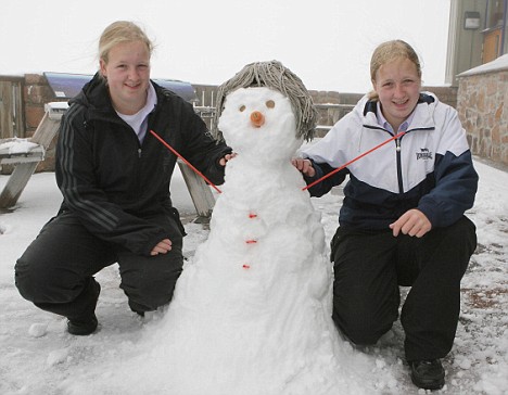 Twins Elizabeth (left) and Jeanette McGregor play in the snow in Aviemore
Snow “hanging on” at Pikes Peak:
http://www.gazette.com/articles/snow-55881-peak-springs.html
Alberta and Saskatchewan get snow in June
http://www.calgaryherald.com/Technology/Alberta+Saskatchewan+snow+June/1670900/story
6 06 2009
KXNewsTeam
Snow falls in western ND, in June
BISMARCK, N.D. (AP) Snow has fallen in Dickinson in June, the first time in nearly 60 years the city has seen snow past May.
National Weather Service meteorologist Janine Vining in Bismarck says there were unofficial reports of a couple of inches of snow in Dickinson on Saturday.
Vining says snow in North Dakota in June is uncommon, though it’s not unheard of. She says other parts of the state have seen June snow within the past 10 years.
Williston and Bismarck had received only rain as of mid-Saturday, but Vining said snow was possible in those cities later in the day.
But wait there’s more snowy June weather worldwide:
See also: Schoolchildren rescued from hiking trip as June snow and cold hits California
http://www.modbee.com/local/story/732997.html
Great British summer goes from sweltering to shivering in just a week
http://www.dailymail.co.uk/news/article-1191089/Its-June–snowing-From-sweltering-shivering-just-week-happen-great-British-summer.html
Snow “hanging on” at Pikes Peak:
http://www.gazette.com/articles/snow-55881-peak-springs.html
Alberta and Saskatchewan get snow in June
http://www.calgaryherald.com/Technology/Alberta+Saskatchewan+snow+June/1670900/story
Frost in July hits P.E.I.
Wednesday, July 8, 2009
CBC News
Temperatures dropped to a record low in Prince Edward Island overnight Tuesday, with reports of frost throughout the province.
An official record low of 3.8 C was set early Wednesday morning at Charlottetown airport.
The previous record for that date was 5.1 C, set in 2005.
Bob Robichaud, a meteorologist with Environment Canada, said that to his knowledge, frost has never been reported before in July in P.E.I.
"That 3.8 we got last night kind of sticks out as being lower than some of the other records for anytime in early July," Robichaud told CBC News on Wednesday.
"So we're looking at a significant event," he said.
Environment Canada has issued a frost risk warning in low-lying areas of the province for Wednesday night. The temperature is expected to dip to 4 C.
Fascinating. The mean temperature fluctuates. How about that, huh? the plus sign in front of the numbers means that the temperature has been above average for that time period. Hence 0.4 is higher than normal. Yes, it is lower than 0.9 but it is still higher than normal.UAH global temperature anomaly for May – down again, near zero
5 06 2009
Graph by Anthony (click for larger image) text by Dr. Roy Spencer from his blog here
May 2009 Global Temperature Update +0.04 deg. C
June 4th, 2009 by Roy W. Spencer, Ph. D.
YR MON GLOBE NH SH TROPICS
2009 1 0.304 0.443 0.165 -0.036
2009 2 0.347 0.678 0.016 0.051
2009 3 0.206 0.310 0.103 -0.149
2009 4 0.090 0.124 0.056 -0.014
2009 5 0.043 0.043 0.043 -0.168
May 2009 saw another drop in the global average temperature anomaly, from +0.09 deg. C in April to +0.04 deg. C in May, originating mostly from the Northern Hemisphere and the tropics.
I still see a general upward direction on the average of the anomalies since 1978 on your graph.
