A hidden Bronze Age landscape, thought to be 4,500 years old, has been discovered on a remote island off the coast of Wales.
Researchers used lasers to create a 3D model of Ramsey Island which revealed burial grounds, a prehistoric coastal fort and the possible site of a lost chapel.
The island - about a mile off the coast of St David's Head in Pembrokeshire - will now be studied by experts to understand how humans once used the area.
Long-lost Bronze Age landscape on Ramsey Island featuring forts, burial grounds and the site of a 4,500-year-old chapel is found using lasers
The island is about a mile off the coast of St David's Head in Pembrokeshire
Remains were found after an airborne laser survey created a model of the area
The scan was part of the EU-funded CHERISH Project to investigate the effects of climate change
By Ellie Zolfagharifard for MailOnline
2 April 2018
A hidden Bronze Age landscape, thought to be 4,500 years old, has been discovered on a remote island off the coast of Wales.
Researchers used lasers to create a 3D model of Ramsey Island which revealed burial grounds, a prehistoric coastal fort and the possible site of a lost chapel.
The island - about a mile off the coast of St David's Head in Pembrokeshire - will now be studied by experts to understand how humans once used the area.
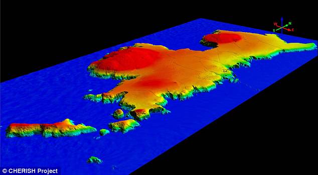
Shown is a 3D view of Ramsey Island from the south-east generated from the Lidar imaging. Colours differentiate height above sea level. The technology measures distance by shooting a laser at a target and analysing the light that is reflected back
The Lidar scans were part of the EU-funded CHERISH Project to investigate the effects of climate change, and was commissioned by the Royal Commission on the Ancient and Historical Monuments of Wales.
Dan Hunt, CHERISH archaeologist at the Royal Commission, said the information gained from the scan of the 2-mile long island was 'incredible'.
He said: 'We have added a wealth of new archaeological sites to the story of Ramsey Island, using an incredible 3D dataset which has presented us with a stunning view of the island in enormous detail.
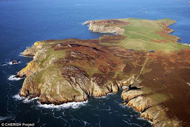
The airborne laser survey was commissioned by archaeologists from the Royal Commission on the Ancient and Historical Monuments of Wales as part of the new European-funded Ireland-Wales CHERISH project
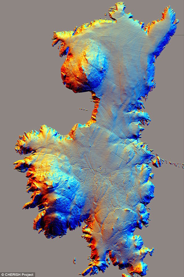
Shown here is airborne laser scanning (Lidar) of Ramsey Island. The prehistoric landscape of Ramsey Island extends to the northern most tip of the island where the site of a possible prehistoric coastal fort
'We look forward to working closely with the wardens of RSPB Ramsey Island, and other colleagues in Pembrokeshire Coast National Park, to investigate these discoveries further.'
The island, which is managed and owned by the RSPB charity, has long been a place of scientific interest.
Previous surveys that were carried out during the mid-1990s recorded prehistoric cairns and field systems on its two summits, according to the BBC.
The airborne laser survey has shed further light on the island's past.
It was done using Lidar, a remote sensing technology that measures distance by shooting a laser at a target and analysing the light that is reflected back.
The prehistoric landscape of Ramsey Island extends to the northern most tip of the island where the site of a possible prehistoric coastal fort has been identified on the high rocky site of Trwyn-Siôn-Owen.
This defended coastal fort was probably a permanent defended settlement or a gathering place for people living and farming on the island.
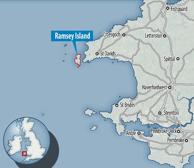
Ramsey Island - about a mile off the coast of St David's Head in Pembrokeshire - will now be studied by experts to understand how humans once used the island
The medieval and post-medieval periods can also be seen on the Island.
Much of this evidence comprises ancient plough ridges, mostly confined to northern and central areas.
However, researchers say there are also earthworks that suggest settlement, industry and religious practice.
To the north of Carn Ysgubor are the remains of medieval and post-medieval ridge and furrow.
Emerging from the ridges are the remains of an earthen platform, possibly the former site of a small rectangular building.
North of this area is the possible site of the lost chapel ‘Capel Dyfanog’.
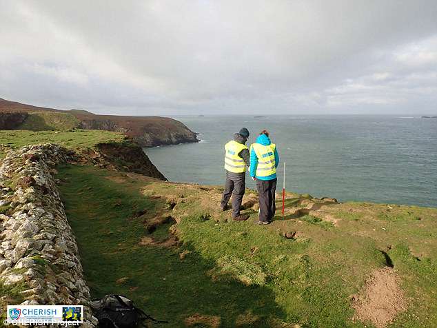
The discoveries could change our view on humans interacted with Ramsey Island during the past 4,000 to 5,000 years
Here the remains of a complex formed of ponds, platforms and enclosures, which straddle the east coast of the island, represent a fitting site for a medieval ecclesiastical precinct that would have afforded a unique view across the waters of Ramsey Sound towards the city of St Davids.
The discoveries could change our view on humans interacted with Ramsey Island during the past 4,000 to 5,000 years.
WHAT IS LIDAR TECHNOLOGY AND HOW DOES IT WORK?
Lidar is a remote sensing technology that measures distance by shooting a laser at a target and analysing the light that is reflected back.
The technology was developed in the early 1960s and uses laser imaging with radar technology that can calculate distances.
It was first used in meteorology to measure clouds by the National Center for Atmospheric Research.
The term lidar is a portmanteau of 'light and 'radar.'
Lidar uses ultraviolet, visible, or near infrared light to image objects and can be used with a wide range of targets, including non-metallic objects, rocks, rain, chemical compounds, aerosols, clouds and even single molecules.
A narrow laser beam can be used to map physical features with very high resolution.
This new technique allowed researchers to map outlines of what they describe as dozens of newly discovered Maya cities hidden under thick jungle foliage centuries after they were abandoned by their original inhabitants.
Aircraft with a LiDAR scanner produced three-dimensional maps of the surface by using light in the form of pulsed laser linked to a GPS system.
The technology helped researchers discover sites much faster than using traditional archaeological methods.
Researchers used lasers to create a 3D model of Ramsey Island which revealed burial grounds, a prehistoric coastal fort and the possible site of a lost chapel.
The island - about a mile off the coast of St David's Head in Pembrokeshire - will now be studied by experts to understand how humans once used the area.
Long-lost Bronze Age landscape on Ramsey Island featuring forts, burial grounds and the site of a 4,500-year-old chapel is found using lasers
The island is about a mile off the coast of St David's Head in Pembrokeshire
Remains were found after an airborne laser survey created a model of the area
The scan was part of the EU-funded CHERISH Project to investigate the effects of climate change
By Ellie Zolfagharifard for MailOnline
2 April 2018
A hidden Bronze Age landscape, thought to be 4,500 years old, has been discovered on a remote island off the coast of Wales.
Researchers used lasers to create a 3D model of Ramsey Island which revealed burial grounds, a prehistoric coastal fort and the possible site of a lost chapel.
The island - about a mile off the coast of St David's Head in Pembrokeshire - will now be studied by experts to understand how humans once used the area.

Shown is a 3D view of Ramsey Island from the south-east generated from the Lidar imaging. Colours differentiate height above sea level. The technology measures distance by shooting a laser at a target and analysing the light that is reflected back
The Lidar scans were part of the EU-funded CHERISH Project to investigate the effects of climate change, and was commissioned by the Royal Commission on the Ancient and Historical Monuments of Wales.
Dan Hunt, CHERISH archaeologist at the Royal Commission, said the information gained from the scan of the 2-mile long island was 'incredible'.
He said: 'We have added a wealth of new archaeological sites to the story of Ramsey Island, using an incredible 3D dataset which has presented us with a stunning view of the island in enormous detail.

The airborne laser survey was commissioned by archaeologists from the Royal Commission on the Ancient and Historical Monuments of Wales as part of the new European-funded Ireland-Wales CHERISH project

Shown here is airborne laser scanning (Lidar) of Ramsey Island. The prehistoric landscape of Ramsey Island extends to the northern most tip of the island where the site of a possible prehistoric coastal fort
'We look forward to working closely with the wardens of RSPB Ramsey Island, and other colleagues in Pembrokeshire Coast National Park, to investigate these discoveries further.'
The island, which is managed and owned by the RSPB charity, has long been a place of scientific interest.
Previous surveys that were carried out during the mid-1990s recorded prehistoric cairns and field systems on its two summits, according to the BBC.
The airborne laser survey has shed further light on the island's past.
It was done using Lidar, a remote sensing technology that measures distance by shooting a laser at a target and analysing the light that is reflected back.
The prehistoric landscape of Ramsey Island extends to the northern most tip of the island where the site of a possible prehistoric coastal fort has been identified on the high rocky site of Trwyn-Siôn-Owen.
This defended coastal fort was probably a permanent defended settlement or a gathering place for people living and farming on the island.

Ramsey Island - about a mile off the coast of St David's Head in Pembrokeshire - will now be studied by experts to understand how humans once used the island
The medieval and post-medieval periods can also be seen on the Island.
Much of this evidence comprises ancient plough ridges, mostly confined to northern and central areas.
However, researchers say there are also earthworks that suggest settlement, industry and religious practice.
To the north of Carn Ysgubor are the remains of medieval and post-medieval ridge and furrow.
Emerging from the ridges are the remains of an earthen platform, possibly the former site of a small rectangular building.
North of this area is the possible site of the lost chapel ‘Capel Dyfanog’.

The discoveries could change our view on humans interacted with Ramsey Island during the past 4,000 to 5,000 years
Here the remains of a complex formed of ponds, platforms and enclosures, which straddle the east coast of the island, represent a fitting site for a medieval ecclesiastical precinct that would have afforded a unique view across the waters of Ramsey Sound towards the city of St Davids.
The discoveries could change our view on humans interacted with Ramsey Island during the past 4,000 to 5,000 years.
WHAT IS LIDAR TECHNOLOGY AND HOW DOES IT WORK?
Lidar is a remote sensing technology that measures distance by shooting a laser at a target and analysing the light that is reflected back.
The technology was developed in the early 1960s and uses laser imaging with radar technology that can calculate distances.
It was first used in meteorology to measure clouds by the National Center for Atmospheric Research.
The term lidar is a portmanteau of 'light and 'radar.'
Lidar uses ultraviolet, visible, or near infrared light to image objects and can be used with a wide range of targets, including non-metallic objects, rocks, rain, chemical compounds, aerosols, clouds and even single molecules.
A narrow laser beam can be used to map physical features with very high resolution.
This new technique allowed researchers to map outlines of what they describe as dozens of newly discovered Maya cities hidden under thick jungle foliage centuries after they were abandoned by their original inhabitants.
Aircraft with a LiDAR scanner produced three-dimensional maps of the surface by using light in the form of pulsed laser linked to a GPS system.
The technology helped researchers discover sites much faster than using traditional archaeological methods.