The men were nearby. It's all good.Shit happens.Most certainly not the first prescribed fire that didn’t read the game plan before getting out of control.
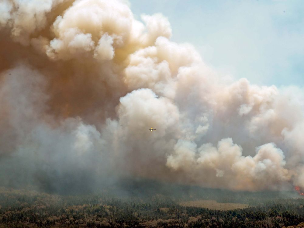
Canada: Alberta wildfires force nearly 30,000 residents to flee
- Thread starter Wise
- Start date
You are using an out of date browser. It may not display this or other websites correctly.
You should upgrade or use an alternative browser.
You should upgrade or use an alternative browser.

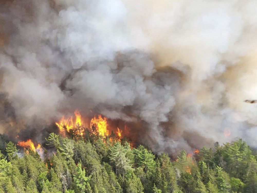
Wildfire in southern N.S. occurred amid some of driest recorded conditions: Scientist
Author of the article:Canadian Press
Canadian Press
Published Jun 17, 2023 • 1 minute read
HALIFAX — A federal scientist with the Canadian Forest Service is pointing to the driest conditions since the Second World War as a key factor behind the largest wildfire in Nova Scotia in the past century.
Sylvie Gauthier says she reviewed the records and found the 235-square-kilometre fire in Barrington Lake that swept over bogs, fields and woodlands in southern Nova Scotia had the fourth highest rating for dryness of the woods since 1900, and the highest since 1944.
The province’s Department of Natural Resources says the fire, which forced 6,000 evacuations and destroyed 60 houses and cottages, was the largest wildfire since the early 1920s when it began keeping records.
Gauthier says the extreme dryness, along with coastal winds, may have enabled the fire to burn through the roughly 17 per cent of Crown lands rated as “wet” trees, and to burn or move across fields and bogs that make up about a quarter of Crown land in the area.
Anthony Taylor, a forest ecologist at the University of New Brunswick, says up until the recent fires, there had been a downward trend in the Maritimes in wildfires over the past century due to humans’ growing ability to extinguish such blazes.
But he cites recent research papers indicating climate change is expected to increase average temperatures “by several degrees” in the next three decades, creating an increase in the number of days each year when fires are likely.
 torontosun.com
Author of the article:Canadian Press
Canadian Press
Published Jun 17, 2023 • 1 minute read
HALIFAX — A federal scientist with the Canadian Forest Service is pointing to the driest conditions since the Second World War as a key factor behind the largest wildfire in Nova Scotia in the past century.
Sylvie Gauthier says she reviewed the records and found the 235-square-kilometre fire in Barrington Lake that swept over bogs, fields and woodlands in southern Nova Scotia had the fourth highest rating for dryness of the woods since 1900, and the highest since 1944.
The province’s Department of Natural Resources says the fire, which forced 6,000 evacuations and destroyed 60 houses and cottages, was the largest wildfire since the early 1920s when it began keeping records.
Gauthier says the extreme dryness, along with coastal winds, may have enabled the fire to burn through the roughly 17 per cent of Crown lands rated as “wet” trees, and to burn or move across fields and bogs that make up about a quarter of Crown land in the area.
Anthony Taylor, a forest ecologist at the University of New Brunswick, says up until the recent fires, there had been a downward trend in the Maritimes in wildfires over the past century due to humans’ growing ability to extinguish such blazes.
But he cites recent research papers indicating climate change is expected to increase average temperatures “by several degrees” in the next three decades, creating an increase in the number of days each year when fires are likely.
Wildfire in southern N.S. occurred amid some of driest recorded conditions: Scientist
A federal scientist with the Canadian Forest Service is pointing to the driest conditions since the Second World War
gubmint 'scientists' can't really be trusted, can they?
they get told what they can and can't say.
gotta be glow-bull warming
they get told what they can and can't say.
gotta be glow-bull warming
Name a research paper that has ever nailed a prediction.But he cites recent research papers indicating climate change is expected to increase average temperatures “by several degrees” in the next three decades, creating an increase in the number of days each year when fires are likely.
The province’s Department of Natural Resources says the fire, which forced 6,000 evacuations and destroyed 60 houses and cottages, was the largest wildfire since the early 1920s when it began keeping records.
Gauthier says the extreme dryness, along with coastal winds, may have enabled the fire to burn through the roughly 17 per cent of Crown lands rated as “wet” trees, and to burn or move across fields and bogs that make up about a quarter of Crown land in the area.
It is the largest wildfire since keeping records, indeed. That is sure a huge surface area. Let's hope humans indeed have increasing abilities to stop forest fires.
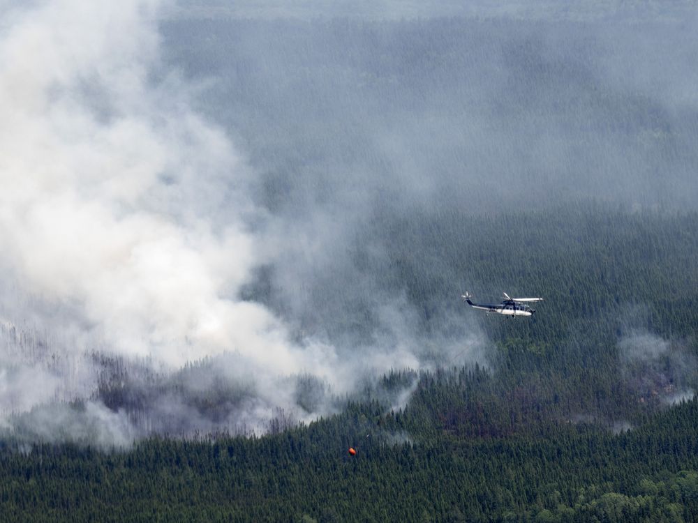
Canada, United States expand agreement to help each other fight wildfires
Author of the article:Canadian Press
Canadian Press
Mia Rabson
Published Jun 22, 2023 • Last updated 1 day ago • 3 minute read
OTTAWA — Canada and the United States agreed to replace an “ad hoc” approach to helping each other battle forest fires with a formal agreement Thursday that spells out a plan to more efficiently share resources and expertise across the border.
The agreement comes as Canada continues to face a record-setting fire season, with more than 63,000 square kilometres of land burned so far this year.
Several thousand international firefighters from at least nine different countries have been seconded to help.
U.S. Ambassador David Cohen said more than 1,500 American firefighters have come north to help Canada this year.
But both he and Natural Resources Minister Jonathan Wilkinson said the agreements the two countries had in place to help guide how fire resources are shared were outdated and inefficient.
They signed a memorandum of understanding on the matter Thursday that outlines the process both must follow to request and send resources.
It also promises that the two countries will co-operate on technology, training and research, given that climate change is increasing the risk of fires.
“In the past, the wildland fire resources sharing between our two countries was pretty much ad hoc,” said Wilkinson.
“It relied on a number of different arrangements, and they were only focused on fire suppression. This MOU will allow better co-ordination with our partners at the provinces and territories to ensure adequate firefighting resources.”
The new agreement includes a list of all the organizations that would co-operate, including the organization or department in each province responsible for fighting wildfires as well as multiple national departments.
Those include the U.S. National Park Service, Parks Canada, the Canadian Forest Service, the U.S. Fish and Wildlife Service and the U.S. Department of Agriculture Forest Service.
Cohen said he thinks laying out that list is the most critical part of the agreement, and it spells out “that there is a will here to help.”
“That has never been the issue,” he added.
“But sometimes getting it organized in a time of crisis takes more time than we would like. And so this provides a structure and a commitment by both governments, and multiple agencies within both governments, that we will work together. We will respond.”
Unlike the United States, Canada does not have a national agency charged with responding to disasters, be they of the human or natural cause.
The U.S. has the Federal Emergency Management Agency, or FEMA, and Canada is in discussions about creating something similar on this side of the border.
But right now, firefighting is a provincial responsibility and provinces ask Ottawa for help when they can’t manage on their own.
Cohen said it’s up to Canada to decide whether a northern FEMA is the right answer, but the agreement on fires is a bit of a step toward that.
“Part of what we’re doing in this agreement is to create a bit of (room) to give Canada the benefit and advantage of being able to function with a co-ordination within its government as a result of the arrangement, as if there was a FEMA in Canada,” he said.
Blair said Thursday he does not want Canada to break any records for the number of fires or area burned, but the spring has been brutal for the hot, dry weather fires love and the summer looks to bring more of the same.
The most area ever burned in a single year was in 1995 at 71,000 square kilometres.
On Thursday, Canada surpassed 63,000 square kilometres, making it the second-worst year on record before the hottest months of the year have even begun.
The Canadian Interagency Forest Fire Centre said that as of Thursday, 2,769 fires had burned in Canada so far this year, and 422 remained active. There were 209 fires out of control.
Over the last 25 years, the average amount of land that has usually burned by this point in the year has been about 4,600 square kilometres.

 torontosun.com
Author of the article:Canadian Press
Canadian Press
Mia Rabson
Published Jun 22, 2023 • Last updated 1 day ago • 3 minute read
OTTAWA — Canada and the United States agreed to replace an “ad hoc” approach to helping each other battle forest fires with a formal agreement Thursday that spells out a plan to more efficiently share resources and expertise across the border.
The agreement comes as Canada continues to face a record-setting fire season, with more than 63,000 square kilometres of land burned so far this year.
Several thousand international firefighters from at least nine different countries have been seconded to help.
U.S. Ambassador David Cohen said more than 1,500 American firefighters have come north to help Canada this year.
But both he and Natural Resources Minister Jonathan Wilkinson said the agreements the two countries had in place to help guide how fire resources are shared were outdated and inefficient.
They signed a memorandum of understanding on the matter Thursday that outlines the process both must follow to request and send resources.
It also promises that the two countries will co-operate on technology, training and research, given that climate change is increasing the risk of fires.
“In the past, the wildland fire resources sharing between our two countries was pretty much ad hoc,” said Wilkinson.
“It relied on a number of different arrangements, and they were only focused on fire suppression. This MOU will allow better co-ordination with our partners at the provinces and territories to ensure adequate firefighting resources.”
The new agreement includes a list of all the organizations that would co-operate, including the organization or department in each province responsible for fighting wildfires as well as multiple national departments.
Those include the U.S. National Park Service, Parks Canada, the Canadian Forest Service, the U.S. Fish and Wildlife Service and the U.S. Department of Agriculture Forest Service.
Cohen said he thinks laying out that list is the most critical part of the agreement, and it spells out “that there is a will here to help.”
“That has never been the issue,” he added.
“But sometimes getting it organized in a time of crisis takes more time than we would like. And so this provides a structure and a commitment by both governments, and multiple agencies within both governments, that we will work together. We will respond.”
Unlike the United States, Canada does not have a national agency charged with responding to disasters, be they of the human or natural cause.
The U.S. has the Federal Emergency Management Agency, or FEMA, and Canada is in discussions about creating something similar on this side of the border.
But right now, firefighting is a provincial responsibility and provinces ask Ottawa for help when they can’t manage on their own.
Cohen said it’s up to Canada to decide whether a northern FEMA is the right answer, but the agreement on fires is a bit of a step toward that.
“Part of what we’re doing in this agreement is to create a bit of (room) to give Canada the benefit and advantage of being able to function with a co-ordination within its government as a result of the arrangement, as if there was a FEMA in Canada,” he said.
Blair said Thursday he does not want Canada to break any records for the number of fires or area burned, but the spring has been brutal for the hot, dry weather fires love and the summer looks to bring more of the same.
The most area ever burned in a single year was in 1995 at 71,000 square kilometres.
On Thursday, Canada surpassed 63,000 square kilometres, making it the second-worst year on record before the hottest months of the year have even begun.
The Canadian Interagency Forest Fire Centre said that as of Thursday, 2,769 fires had burned in Canada so far this year, and 422 remained active. There were 209 fires out of control.
Over the last 25 years, the average amount of land that has usually burned by this point in the year has been about 4,600 square kilometres.
Canada, United States expand agreement to help each other fight wildfires
Canada and the United States are expanding an agreement to share people and equipment to fight wildfires.
What’s in the air can endanger your health
Aerosol hazards include anything that is in the air, including smoke, fumes, dust, mist and fog
Author of the article:Alex Vezina
Published Jun 24, 2023 • Last updated 2 days ago • 3 minute read
In the wake of wildfire smoke blanketing cities across North America, people are asking how dangerous this is to our health.
As with many things, it depends, but you’re well-advised to avoid breathing it if you can.
Aerosol hazards include anything that is in the air, including smoke, fumes, dust, mist and fog.
When it comes to your health, the issue is less about what type of aerosol it is, and more about what is specifically being distributed in the air.
With smoke, an aerosol produced from combustion (fire), it is generally correct to assume that whatever was burning has now being distributed in the smoke.
A bonfire started by using paper and wood will contain wood and paper particulates, as well as particulates of anything else people decide to throw into the fire.
In a housefire, the smoke can contain industrial insulation particulates, highly toxic if ingested, especially if it contains fibreglass.
Firefighters have significantly higher rates of cancer, especially lung cancer, than the general population because of the dangerous aerosols they ingest while fighting fires.
Another example is the well-documented health complications of 911 responders.
If people need or want to go outside when, for example, the smoke from wildfires is so intense that it endangers their health, wearing some sort of breathing filter is a good starting point.
Emergency responders have breathing gear when going into a toxic environment, for that reason.
Similarly, wearing a mask when you’re painting is advisable because some protection from the fumes is better than no protection.
If you still have N-95 or KN-95 masks from the pandemic, or any other type of mask that protects against fumes associated with home renovation, it’s advisable to wear them outside when smoke levels are intense because it reduces the amount of aerosol hazards your body has to filter.
Aerosol hazards such as fibreglass particulates do not behave like a virus or bacteria.
They do not multiply on their own.
No one needs a regular dose of ingested fibreglass, paint fumes or wood particulates due to a wildfire to ensure their immune system is operating at peak efficiency.
To understand just how scary air pollution can become consider the air quality issues in China.
In 2015, Chai Jing, an investigative reporter in China made a documentary titled Under the Dome.
A week after it was released, it was banned by the government because it feared people would take collective action demanding better protection against smog if informed of the facts.
The documentary included an estimate from a former minister of the environment that 500,000 children under two months of age were dying annually due to black-carbon particulates contained within the smog.
This documentary is available on the internet and can be viewed with subtitles.
While the wildfire smoke we’ve been experiencing in North America does not contain the same particulates as smog in China, public health agencies are wise to caution people against going outside in times of hazardous smoke levels, particularly those with pre-existing medical conditions that impede their breathing.
For similar reasons, it’s wise to cancel outdoor sports events.
There is some debate — following the experience of the pandemic — that the government should require people to stay indoors when smoke from wildfires is at a hazardous level.
But since exposure to smoke is not contagious the way a virus is and many people would disobey an edict to remain in their homes, such action is unlikely.
It makes more sense to continually caution people about the potential dangers of breathing in smoke from wildfires and advising people to reduce their risk by staying indoors as much as possible.
– Vezina is the CEO of Prepared Canada Corp. and teaches Disaster and Emergency Management at York University. He can be reached at info@prepared.ca.
 torontosun.com
Aerosol hazards include anything that is in the air, including smoke, fumes, dust, mist and fog
Author of the article:Alex Vezina
Published Jun 24, 2023 • Last updated 2 days ago • 3 minute read
In the wake of wildfire smoke blanketing cities across North America, people are asking how dangerous this is to our health.
As with many things, it depends, but you’re well-advised to avoid breathing it if you can.
Aerosol hazards include anything that is in the air, including smoke, fumes, dust, mist and fog.
When it comes to your health, the issue is less about what type of aerosol it is, and more about what is specifically being distributed in the air.
With smoke, an aerosol produced from combustion (fire), it is generally correct to assume that whatever was burning has now being distributed in the smoke.
A bonfire started by using paper and wood will contain wood and paper particulates, as well as particulates of anything else people decide to throw into the fire.
In a housefire, the smoke can contain industrial insulation particulates, highly toxic if ingested, especially if it contains fibreglass.
Firefighters have significantly higher rates of cancer, especially lung cancer, than the general population because of the dangerous aerosols they ingest while fighting fires.
Another example is the well-documented health complications of 911 responders.
If people need or want to go outside when, for example, the smoke from wildfires is so intense that it endangers their health, wearing some sort of breathing filter is a good starting point.
Emergency responders have breathing gear when going into a toxic environment, for that reason.
Similarly, wearing a mask when you’re painting is advisable because some protection from the fumes is better than no protection.
If you still have N-95 or KN-95 masks from the pandemic, or any other type of mask that protects against fumes associated with home renovation, it’s advisable to wear them outside when smoke levels are intense because it reduces the amount of aerosol hazards your body has to filter.
Aerosol hazards such as fibreglass particulates do not behave like a virus or bacteria.
They do not multiply on their own.
No one needs a regular dose of ingested fibreglass, paint fumes or wood particulates due to a wildfire to ensure their immune system is operating at peak efficiency.
To understand just how scary air pollution can become consider the air quality issues in China.
In 2015, Chai Jing, an investigative reporter in China made a documentary titled Under the Dome.
A week after it was released, it was banned by the government because it feared people would take collective action demanding better protection against smog if informed of the facts.
The documentary included an estimate from a former minister of the environment that 500,000 children under two months of age were dying annually due to black-carbon particulates contained within the smog.
This documentary is available on the internet and can be viewed with subtitles.
While the wildfire smoke we’ve been experiencing in North America does not contain the same particulates as smog in China, public health agencies are wise to caution people against going outside in times of hazardous smoke levels, particularly those with pre-existing medical conditions that impede their breathing.
For similar reasons, it’s wise to cancel outdoor sports events.
There is some debate — following the experience of the pandemic — that the government should require people to stay indoors when smoke from wildfires is at a hazardous level.
But since exposure to smoke is not contagious the way a virus is and many people would disobey an edict to remain in their homes, such action is unlikely.
It makes more sense to continually caution people about the potential dangers of breathing in smoke from wildfires and advising people to reduce their risk by staying indoors as much as possible.
– Vezina is the CEO of Prepared Canada Corp. and teaches Disaster and Emergency Management at York University. He can be reached at info@prepared.ca.
VEZINA: What’s in the air can endanger your health
In the wake of wildfire smoke blanketing cities across North America, people are asking how dangerous this is to our health.
Forest fire centre declares 2023 already worst year ever for Canadian wildfires
Author of the article:Canadian Press
Canadian Press
Morgan Lowrie
Published Jun 26, 2023 • 4 minute read
MONTREAL — Canada surpassed the record for area burned by wildfires in a single year Monday as hundreds of fires continued to blaze in almost every province and territory.
The Canadian Interagency Forest Fire Centre reported Monday afternoon that 76,129 square kilometres of forest and other land has burned since Jan. 1. That exceeds the previous record set in 1989 of 75,596 square kilometres, according to the National Forestry Database.
Last week federal Emergency Preparedness Minister Bill Blair said he wasn’t “looking to break any records” but acknowledged it was likely coming. “Unfortunately the fire season this year started earlier and has been more widespread across the country than in recent memory,” he said.
It took less than six months to surpass the previous record for an entire year. And in 1989, more than 11,000 different fires combined to create the total, with an average size of about seven square kilometres. This year, there have been less than 3,000 fires so far, but they have averaged about 26 square kilometres in size.
Currently there are 490 fires burning nationally, with 255 of them considered to be out of control.
In Quebec, where nearly a quarter of the fires are burning, heavy smoke grounded water bombers in the province’s north Monday and caused widespread smog warnings farther south.
Nicolas Vigneault, a spokesman for the province’s forest fire prevention agency, said the smoke had reduced visibility, making it impossible for some water bombers and helicopters to take off.
“We do as (many) operations as we can in the field with the firefighters, and in the air with the planes and helicopters,” he said. “But our priority is the security of everybody, and the smoke is a challenge right now, and it’s been a challenge over the last two or three days.”
However, he said heavy rain and some wind is expected in the most affected parts of the province in the coming days, which should allow operations to resume “almost normally.”
While no towns are under immediate risk of burning, the fires have forced thousands of Quebecers from their homes. That includes the 2,000 residents of Lebel-sur-Quevillon, parts of Val-d’Or and Senneterre and some Indigenous communities.
In a Monday afternoon update, the fire prevention agency said the fire burning near Lebel-sur-Quevillon remained out of control, and had grown to more than 4,400 square kilometres.
“Again yesterday, the lack of visibility for our aircraft had an impact on fire suppression operations” at the Lebel-sur-Quevillon fire, the agency wrote on its Facebook page. “We did some tests, but no plane or helicopter could complete a mission due to the dense smoke.”
It said “significant” rain was expected in the northwest of the province beginning late Monday or Tuesday, but strong winds ahead of the wet weather could make fire conditions challenging.
The Cree Nation of Mistissini announced late Sunday that it was asking all remaining community members to evacuate the area due to a fire threatening nearby Highway 167.
“The dryness index is 100, the highest that can be recorded, and the intensity of the fire is really high,” read one of a series of posts on the community’s Facebook page.
Authorities noted that the forest fire agency was unable to get images of the fire due to low visibility, which made it hard to track its progress. A plan was in the works to protect the community by widening firebreaks, bringing in water tankers to combat spot fires and putting sprinklers at the entrance to the community.
Meanwhile, heavy smoke forced the Cree community of Waswanipi to announce plans to evacuate another 50 residents, including seniors, pregnant women and infants under one year old.
In a video update late Sunday, Chief Irene Neeposh asked residents who remained in the community to keep their children inside, keep their doors and windows closed and wear a proper-fitting mask while outside.
“We are strongly, I repeat strongly, advising that you do not let your children play outside,” she said. “The smoke being this dense is extremely toxic.”
There was better news in three small communities near the Ontario border, where officials said the more than 300 residents of Val-Paradis, Beaucanton and Lac Pajegasque could go home after being forced to leave on Friday.
The Atikamekw of Opitciwan, about 600 kilometres north of Montreal, also announced that residents of the area who had been evacuated would be allowed to return on Tuesday.
Environment Canada issued smog warnings for much of the province, including Montreal and Quebec City, due to poor air quality caused by fine particles in the air. The department also issued special weather statements for many of those same cities, forecasting 20 to 40 millimetres of rain in some areas, with more than 50 mm possible in thunderstorms.
By late afternoon, the smog warnings had been lifted for the south of the province between Quebec City and Montreal, though they remained in place in the Gatineau region near Ottawa, the Abitibi region in the northwest and the Lac-St-Jean region north of Quebec City.
 torontosun.com
Author of the article:Canadian Press
Canadian Press
Morgan Lowrie
Published Jun 26, 2023 • 4 minute read
MONTREAL — Canada surpassed the record for area burned by wildfires in a single year Monday as hundreds of fires continued to blaze in almost every province and territory.
The Canadian Interagency Forest Fire Centre reported Monday afternoon that 76,129 square kilometres of forest and other land has burned since Jan. 1. That exceeds the previous record set in 1989 of 75,596 square kilometres, according to the National Forestry Database.
Last week federal Emergency Preparedness Minister Bill Blair said he wasn’t “looking to break any records” but acknowledged it was likely coming. “Unfortunately the fire season this year started earlier and has been more widespread across the country than in recent memory,” he said.
It took less than six months to surpass the previous record for an entire year. And in 1989, more than 11,000 different fires combined to create the total, with an average size of about seven square kilometres. This year, there have been less than 3,000 fires so far, but they have averaged about 26 square kilometres in size.
Currently there are 490 fires burning nationally, with 255 of them considered to be out of control.
In Quebec, where nearly a quarter of the fires are burning, heavy smoke grounded water bombers in the province’s north Monday and caused widespread smog warnings farther south.
Nicolas Vigneault, a spokesman for the province’s forest fire prevention agency, said the smoke had reduced visibility, making it impossible for some water bombers and helicopters to take off.
“We do as (many) operations as we can in the field with the firefighters, and in the air with the planes and helicopters,” he said. “But our priority is the security of everybody, and the smoke is a challenge right now, and it’s been a challenge over the last two or three days.”
However, he said heavy rain and some wind is expected in the most affected parts of the province in the coming days, which should allow operations to resume “almost normally.”
While no towns are under immediate risk of burning, the fires have forced thousands of Quebecers from their homes. That includes the 2,000 residents of Lebel-sur-Quevillon, parts of Val-d’Or and Senneterre and some Indigenous communities.
In a Monday afternoon update, the fire prevention agency said the fire burning near Lebel-sur-Quevillon remained out of control, and had grown to more than 4,400 square kilometres.
“Again yesterday, the lack of visibility for our aircraft had an impact on fire suppression operations” at the Lebel-sur-Quevillon fire, the agency wrote on its Facebook page. “We did some tests, but no plane or helicopter could complete a mission due to the dense smoke.”
It said “significant” rain was expected in the northwest of the province beginning late Monday or Tuesday, but strong winds ahead of the wet weather could make fire conditions challenging.
The Cree Nation of Mistissini announced late Sunday that it was asking all remaining community members to evacuate the area due to a fire threatening nearby Highway 167.
“The dryness index is 100, the highest that can be recorded, and the intensity of the fire is really high,” read one of a series of posts on the community’s Facebook page.
Authorities noted that the forest fire agency was unable to get images of the fire due to low visibility, which made it hard to track its progress. A plan was in the works to protect the community by widening firebreaks, bringing in water tankers to combat spot fires and putting sprinklers at the entrance to the community.
Meanwhile, heavy smoke forced the Cree community of Waswanipi to announce plans to evacuate another 50 residents, including seniors, pregnant women and infants under one year old.
In a video update late Sunday, Chief Irene Neeposh asked residents who remained in the community to keep their children inside, keep their doors and windows closed and wear a proper-fitting mask while outside.
“We are strongly, I repeat strongly, advising that you do not let your children play outside,” she said. “The smoke being this dense is extremely toxic.”
There was better news in three small communities near the Ontario border, where officials said the more than 300 residents of Val-Paradis, Beaucanton and Lac Pajegasque could go home after being forced to leave on Friday.
The Atikamekw of Opitciwan, about 600 kilometres north of Montreal, also announced that residents of the area who had been evacuated would be allowed to return on Tuesday.
Environment Canada issued smog warnings for much of the province, including Montreal and Quebec City, due to poor air quality caused by fine particles in the air. The department also issued special weather statements for many of those same cities, forecasting 20 to 40 millimetres of rain in some areas, with more than 50 mm possible in thunderstorms.
By late afternoon, the smog warnings had been lifted for the south of the province between Quebec City and Montreal, though they remained in place in the Gatineau region near Ottawa, the Abitibi region in the northwest and the Lac-St-Jean region north of Quebec City.
Forest fire centre declares 2023 already worst year ever for Canadian wildfires
Canada surpassed the record for area burned by wildfires in a single year Monday as hundreds of fires continued to blaze
Good nothing a carbon tax won’t fix .Forest fire centre declares 2023 already worst year ever for Canadian wildfires
Author of the article:Canadian Press
Canadian Press
Morgan Lowrie
Published Jun 26, 2023 • 4 minute read
MONTREAL — Canada surpassed the record for area burned by wildfires in a single year Monday as hundreds of fires continued to blaze in almost every province and territory.
The Canadian Interagency Forest Fire Centre reported Monday afternoon that 76,129 square kilometres of forest and other land has burned since Jan. 1. That exceeds the previous record set in 1989 of 75,596 square kilometres, according to the National Forestry Database.
Last week federal Emergency Preparedness Minister Bill Blair said he wasn’t “looking to break any records” but acknowledged it was likely coming. “Unfortunately the fire season this year started earlier and has been more widespread across the country than in recent memory,” he said.
It took less than six months to surpass the previous record for an entire year. And in 1989, more than 11,000 different fires combined to create the total, with an average size of about seven square kilometres. This year, there have been less than 3,000 fires so far, but they have averaged about 26 square kilometres in size.
Currently there are 490 fires burning nationally, with 255 of them considered to be out of control.
In Quebec, where nearly a quarter of the fires are burning, heavy smoke grounded water bombers in the province’s north Monday and caused widespread smog warnings farther south.
Nicolas Vigneault, a spokesman for the province’s forest fire prevention agency, said the smoke had reduced visibility, making it impossible for some water bombers and helicopters to take off.
“We do as (many) operations as we can in the field with the firefighters, and in the air with the planes and helicopters,” he said. “But our priority is the security of everybody, and the smoke is a challenge right now, and it’s been a challenge over the last two or three days.”
However, he said heavy rain and some wind is expected in the most affected parts of the province in the coming days, which should allow operations to resume “almost normally.”
While no towns are under immediate risk of burning, the fires have forced thousands of Quebecers from their homes. That includes the 2,000 residents of Lebel-sur-Quevillon, parts of Val-d’Or and Senneterre and some Indigenous communities.
In a Monday afternoon update, the fire prevention agency said the fire burning near Lebel-sur-Quevillon remained out of control, and had grown to more than 4,400 square kilometres.
“Again yesterday, the lack of visibility for our aircraft had an impact on fire suppression operations” at the Lebel-sur-Quevillon fire, the agency wrote on its Facebook page. “We did some tests, but no plane or helicopter could complete a mission due to the dense smoke.”
It said “significant” rain was expected in the northwest of the province beginning late Monday or Tuesday, but strong winds ahead of the wet weather could make fire conditions challenging.
The Cree Nation of Mistissini announced late Sunday that it was asking all remaining community members to evacuate the area due to a fire threatening nearby Highway 167.
“The dryness index is 100, the highest that can be recorded, and the intensity of the fire is really high,” read one of a series of posts on the community’s Facebook page.
Authorities noted that the forest fire agency was unable to get images of the fire due to low visibility, which made it hard to track its progress. A plan was in the works to protect the community by widening firebreaks, bringing in water tankers to combat spot fires and putting sprinklers at the entrance to the community.
Meanwhile, heavy smoke forced the Cree community of Waswanipi to announce plans to evacuate another 50 residents, including seniors, pregnant women and infants under one year old.
In a video update late Sunday, Chief Irene Neeposh asked residents who remained in the community to keep their children inside, keep their doors and windows closed and wear a proper-fitting mask while outside.
“We are strongly, I repeat strongly, advising that you do not let your children play outside,” she said. “The smoke being this dense is extremely toxic.”
There was better news in three small communities near the Ontario border, where officials said the more than 300 residents of Val-Paradis, Beaucanton and Lac Pajegasque could go home after being forced to leave on Friday.
The Atikamekw of Opitciwan, about 600 kilometres north of Montreal, also announced that residents of the area who had been evacuated would be allowed to return on Tuesday.
Environment Canada issued smog warnings for much of the province, including Montreal and Quebec City, due to poor air quality caused by fine particles in the air. The department also issued special weather statements for many of those same cities, forecasting 20 to 40 millimetres of rain in some areas, with more than 50 mm possible in thunderstorms.
By late afternoon, the smog warnings had been lifted for the south of the province between Quebec City and Montreal, though they remained in place in the Gatineau region near Ottawa, the Abitibi region in the northwest and the Lac-St-Jean region north of Quebec City.
Forest fire centre declares 2023 already worst year ever for Canadian wildfires
Canada surpassed the record for area burned by wildfires in a single year Monday as hundreds of fires continued to blaze
We have probably surpassed the record number of arsons in our forests this year as well.Forest fire centre declares 2023 already worst year ever for Canadian wildfires
Author of the article:Canadian Press
Canadian Press
Morgan Lowrie
Published Jun 26, 2023 • 4 minute read
MONTREAL — Canada surpassed the record for area burned by wildfires in a single year Monday as hundreds of fires continued to blaze in almost every province and territory.
The Canadian Interagency Forest Fire Centre reported Monday afternoon that 76,129 square kilometres of forest and other land has burned since Jan. 1. That exceeds the previous record set in 1989 of 75,596 square kilometres, according to the National Forestry Database.
Last week federal Emergency Preparedness Minister Bill Blair said he wasn’t “looking to break any records” but acknowledged it was likely coming. “Unfortunately the fire season this year started earlier and has been more widespread across the country than in recent memory,” he said.
It took less than six months to surpass the previous record for an entire year. And in 1989, more than 11,000 different fires combined to create the total, with an average size of about seven square kilometres. This year, there have been less than 3,000 fires so far, but they have averaged about 26 square kilometres in size.
Currently there are 490 fires burning nationally, with 255 of them considered to be out of control.
In Quebec, where nearly a quarter of the fires are burning, heavy smoke grounded water bombers in the province’s north Monday and caused widespread smog warnings farther south.
Nicolas Vigneault, a spokesman for the province’s forest fire prevention agency, said the smoke had reduced visibility, making it impossible for some water bombers and helicopters to take off.
“We do as (many) operations as we can in the field with the firefighters, and in the air with the planes and helicopters,” he said. “But our priority is the security of everybody, and the smoke is a challenge right now, and it’s been a challenge over the last two or three days.”
However, he said heavy rain and some wind is expected in the most affected parts of the province in the coming days, which should allow operations to resume “almost normally.”
While no towns are under immediate risk of burning, the fires have forced thousands of Quebecers from their homes. That includes the 2,000 residents of Lebel-sur-Quevillon, parts of Val-d’Or and Senneterre and some Indigenous communities.
In a Monday afternoon update, the fire prevention agency said the fire burning near Lebel-sur-Quevillon remained out of control, and had grown to more than 4,400 square kilometres.
“Again yesterday, the lack of visibility for our aircraft had an impact on fire suppression operations” at the Lebel-sur-Quevillon fire, the agency wrote on its Facebook page. “We did some tests, but no plane or helicopter could complete a mission due to the dense smoke.”
It said “significant” rain was expected in the northwest of the province beginning late Monday or Tuesday, but strong winds ahead of the wet weather could make fire conditions challenging.
The Cree Nation of Mistissini announced late Sunday that it was asking all remaining community members to evacuate the area due to a fire threatening nearby Highway 167.
“The dryness index is 100, the highest that can be recorded, and the intensity of the fire is really high,” read one of a series of posts on the community’s Facebook page.
Authorities noted that the forest fire agency was unable to get images of the fire due to low visibility, which made it hard to track its progress. A plan was in the works to protect the community by widening firebreaks, bringing in water tankers to combat spot fires and putting sprinklers at the entrance to the community.
Meanwhile, heavy smoke forced the Cree community of Waswanipi to announce plans to evacuate another 50 residents, including seniors, pregnant women and infants under one year old.
In a video update late Sunday, Chief Irene Neeposh asked residents who remained in the community to keep their children inside, keep their doors and windows closed and wear a proper-fitting mask while outside.
“We are strongly, I repeat strongly, advising that you do not let your children play outside,” she said. “The smoke being this dense is extremely toxic.”
There was better news in three small communities near the Ontario border, where officials said the more than 300 residents of Val-Paradis, Beaucanton and Lac Pajegasque could go home after being forced to leave on Friday.
The Atikamekw of Opitciwan, about 600 kilometres north of Montreal, also announced that residents of the area who had been evacuated would be allowed to return on Tuesday.
Environment Canada issued smog warnings for much of the province, including Montreal and Quebec City, due to poor air quality caused by fine particles in the air. The department also issued special weather statements for many of those same cities, forecasting 20 to 40 millimetres of rain in some areas, with more than 50 mm possible in thunderstorms.
By late afternoon, the smog warnings had been lifted for the south of the province between Quebec City and Montreal, though they remained in place in the Gatineau region near Ottawa, the Abitibi region in the northwest and the Lac-St-Jean region north of Quebec City.
Forest fire centre declares 2023 already worst year ever for Canadian wildfires
Canada surpassed the record for area burned by wildfires in a single year Monday as hundreds of fires continued to blaze
Ecologically, friendly, carbon free arsons?We have probably surpassed the record number of arsons in our forests this year as well.
Saw or heard that all fires on Vancouver Island this year are human caused .Ecologically, friendly, carbon free arsons?
Of course they are.Saw or heard that all fires on Vancouver Island this year are human caused .
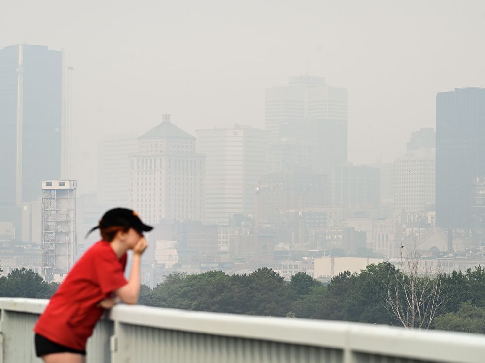
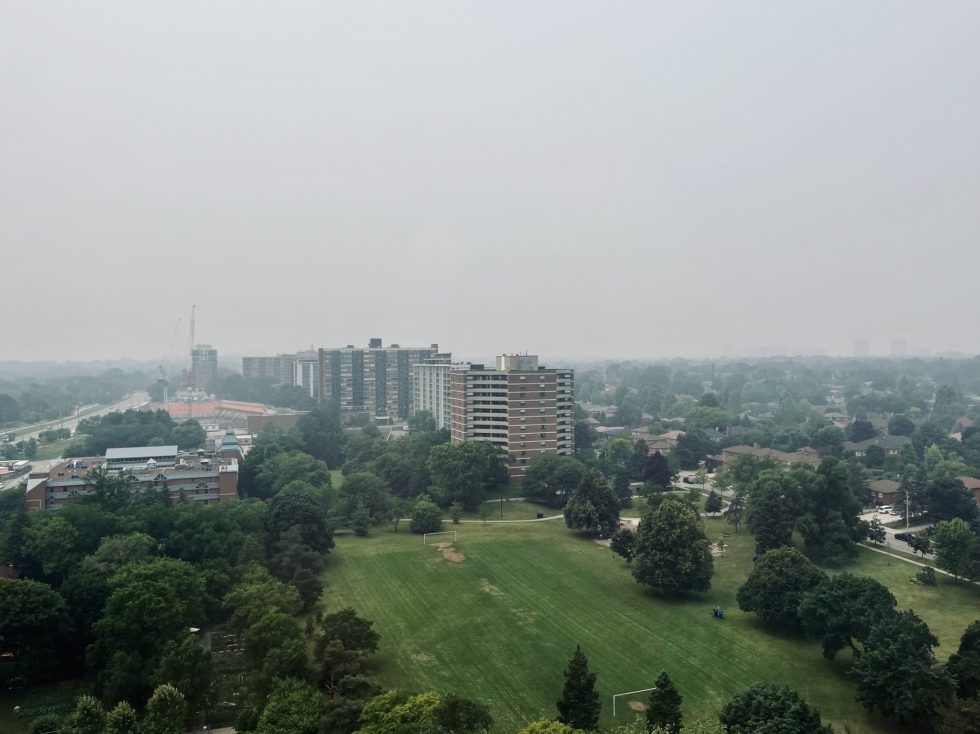
Wildfire smoke makes Toronto's air quality worst in the world
Author of the article:Spiro Papuckoski
Published Jun 28, 2023 • Last updated 2 days ago • 2 minute read
Smoke from wildfires has made Toronto’s air quality the worst in the world.
And Wednesday’s forecast doesn’t look good for the rest of the day.
The pollution from wildfires, burning uncontrollably in northeastern Ontario and Quebec, is drifting into the city and southern parts of the province for the second time this month.
Environment Canada’s Air Quality Health Index rates the city’s air at high risk Wednesday afternoon.
And as of 4 p.m., Toronto has the worst air pollution among major world cities, according to Swiss air quality technology company IQ Air. Dubai, Chicago, Detroit and Minneapolis round out the worst places to breathe.
“Such smoky air in Toronto,” one user posted to Twitter, along with a photo of a hazy sky.
“High levels of air pollution are expected to continue into today due to smoke from forest fires,” Environment Canada said in a special weather statement Wednesday.
The smoke and haze arrived in the city Tuesday and the risk to residents will fluctuate between moderate and high throughout Wednesday, the agency added. The air quality is forecasted to improve by Thursday evening.
The smoke is having an impact on the city.
Although most municipal services are continuing uninterrupted, city-run daycares, recreational and cultural programming will be adjusted, according to Toronto Public Health advice.
Early learning and daycare centres run by the city will not offer outdoor activities, while outdoor museum programs will move indoors.
Outdoor recreation programs will be moved indoors while sport fields, baseball diamonds and parks remain open.
“This is not OK,” said one downtown dweller on Twitter, who also shared a photo of the hazy conditions. “Poor air quality today and the Toronto skyline has been obliterated.”
“Wildfire smoke can be harmful to everyone’s health even at low concentrations,” Environment Canada said. “Everyone can take action to reduce their exposure to wildfire smoke.”
People who are pregnant, young children, older adults and those who have lung or heart disease are at higher risk of experiencing health effects caused by the smoke.
If you work outdoors or must spend time outside, a well-fitted respirator type mask can help reduce your exposure to the fine particles in smoke.
It is advised that people stop or reduce their activity level if breathing becomes uncomfortable or you are feeling unwell.
 weather.gc.ca
weather.gc.ca
weather.gc.ca
 iqair.com
 torontosun.com
Author of the article:Spiro Papuckoski
Published Jun 28, 2023 • Last updated 2 days ago • 2 minute read
Smoke from wildfires has made Toronto’s air quality the worst in the world.
And Wednesday’s forecast doesn’t look good for the rest of the day.
The pollution from wildfires, burning uncontrollably in northeastern Ontario and Quebec, is drifting into the city and southern parts of the province for the second time this month.
Environment Canada’s Air Quality Health Index rates the city’s air at high risk Wednesday afternoon.
And as of 4 p.m., Toronto has the worst air pollution among major world cities, according to Swiss air quality technology company IQ Air. Dubai, Chicago, Detroit and Minneapolis round out the worst places to breathe.
“Such smoky air in Toronto,” one user posted to Twitter, along with a photo of a hazy sky.
“High levels of air pollution are expected to continue into today due to smoke from forest fires,” Environment Canada said in a special weather statement Wednesday.
The smoke and haze arrived in the city Tuesday and the risk to residents will fluctuate between moderate and high throughout Wednesday, the agency added. The air quality is forecasted to improve by Thursday evening.
The smoke is having an impact on the city.
Although most municipal services are continuing uninterrupted, city-run daycares, recreational and cultural programming will be adjusted, according to Toronto Public Health advice.
Early learning and daycare centres run by the city will not offer outdoor activities, while outdoor museum programs will move indoors.
Outdoor recreation programs will be moved indoors while sport fields, baseball diamonds and parks remain open.
“This is not OK,” said one downtown dweller on Twitter, who also shared a photo of the hazy conditions. “Poor air quality today and the Toronto skyline has been obliterated.”
“Wildfire smoke can be harmful to everyone’s health even at low concentrations,” Environment Canada said. “Everyone can take action to reduce their exposure to wildfire smoke.”
People who are pregnant, young children, older adults and those who have lung or heart disease are at higher risk of experiencing health effects caused by the smoke.
If you work outdoors or must spend time outside, a well-fitted respirator type mask can help reduce your exposure to the fine particles in smoke.
It is advised that people stop or reduce their activity level if breathing becomes uncomfortable or you are feeling unwell.
Toronto, Ontario - Air Quality Health Index (AQHI) - Environment Canada
Current values and forecast maximums
Weather Alerts for: City of Toronto - Environment Canada
When severe weather threatens, Environment Canada issues alerts that notify those in affected areas in Ontario so that they can take steps to protect themselves and their property from harm. The type of alert issued depends on the severity and timing of the event. Special statements: issued to...
World Air Quality Index (AQI) Ranking | IQAir
Keep track of the most polluted cities in the world with our air quality index (AQI) ranking.
Wildfire smoke makes Toronto's air quality worst in the world
Smoke from wildfires has made Toronto's air quality the worst in the world.

That used to be a clear day in 1960’s L.A. When and how did Toronto get the monicker The Big Smoke ? Is this worse ?Wildfire smoke makes Toronto's air quality worst in the world
Author of the article:Spiro Papuckoski
Published Jun 28, 2023 • Last updated 2 days ago • 2 minute read
Smoke from wildfires has made Toronto’s air quality the worst in the world.
And Wednesday’s forecast doesn’t look good for the rest of the day.
The pollution from wildfires, burning uncontrollably in northeastern Ontario and Quebec, is drifting into the city and southern parts of the province for the second time this month.
Environment Canada’s Air Quality Health Index rates the city’s air at high risk Wednesday afternoon.
And as of 4 p.m., Toronto has the worst air pollution among major world cities, according to Swiss air quality technology company IQ Air. Dubai, Chicago, Detroit and Minneapolis round out the worst places to breathe.
“Such smoky air in Toronto,” one user posted to Twitter, along with a photo of a hazy sky.
“High levels of air pollution are expected to continue into today due to smoke from forest fires,” Environment Canada said in a special weather statement Wednesday.
The smoke and haze arrived in the city Tuesday and the risk to residents will fluctuate between moderate and high throughout Wednesday, the agency added. The air quality is forecasted to improve by Thursday evening.
The smoke is having an impact on the city.
Although most municipal services are continuing uninterrupted, city-run daycares, recreational and cultural programming will be adjusted, according to Toronto Public Health advice.
Early learning and daycare centres run by the city will not offer outdoor activities, while outdoor museum programs will move indoors.
Outdoor recreation programs will be moved indoors while sport fields, baseball diamonds and parks remain open.
“This is not OK,” said one downtown dweller on Twitter, who also shared a photo of the hazy conditions. “Poor air quality today and the Toronto skyline has been obliterated.”
“Wildfire smoke can be harmful to everyone’s health even at low concentrations,” Environment Canada said. “Everyone can take action to reduce their exposure to wildfire smoke.”
People who are pregnant, young children, older adults and those who have lung or heart disease are at higher risk of experiencing health effects caused by the smoke.
If you work outdoors or must spend time outside, a well-fitted respirator type mask can help reduce your exposure to the fine particles in smoke.
It is advised that people stop or reduce their activity level if breathing becomes uncomfortable or you are feeling unwell.
Toronto, Ontario - Air Quality Health Index (AQHI) - Environment Canada
Current values and forecast maximumsWeather Alerts for: City of Toronto - Environment Canada
When severe weather threatens, Environment Canada issues alerts that notify those in affected areas in Ontario so that they can take steps to protect themselves and their property from harm. The type of alert issued depends on the severity and timing of the event. Special statements: issued to...World Air Quality Index (AQI) Ranking | IQAir
Keep track of the most polluted cities in the world with our air quality index (AQI) ranking.Wildfire smoke makes Toronto's air quality worst in the world
Smoke from wildfires has made Toronto's air quality the worst in the world.
Usually the biggest city in the area or country, like London or New York.When you come from the country, all cities were referred to as The Big Smoke.
I guess Toronto qualifies. Or maybe Tuktoyuktuk.
Record-breaking wildfire season will continue to burn hot for months: Officials
Author of the article:Canadian Press
Canadian Press
Published Jul 06, 2023 • 1 minute read
OTTAWA — Natural Resources Canada says the country’s record-breaking wildfire season will continue to be abnormally intense throughout July and into August.
The projections are based on anticipated high temperatures, dry conditions and historical comparisons.
The risk is expected to shrink slightly in August, but it will remain high across the country.
Canada surpassed the known historic record for total area burned by wildfires in one season on June 27, with months of hot weather still to come.
Some 88,000 square kilometres have burned as of July 5 — nearly 11 times the average amount burned by that date over the past 10 years.
More Canadians have been evacuated from their homes this year than in the last four decades, with more than 155,000 forced to leave due to fire and smoke.
 torontosun.com
Author of the article:Canadian Press
Canadian Press
Published Jul 06, 2023 • 1 minute read
OTTAWA — Natural Resources Canada says the country’s record-breaking wildfire season will continue to be abnormally intense throughout July and into August.
The projections are based on anticipated high temperatures, dry conditions and historical comparisons.
The risk is expected to shrink slightly in August, but it will remain high across the country.
Canada surpassed the known historic record for total area burned by wildfires in one season on June 27, with months of hot weather still to come.
Some 88,000 square kilometres have burned as of July 5 — nearly 11 times the average amount burned by that date over the past 10 years.
More Canadians have been evacuated from their homes this year than in the last four decades, with more than 155,000 forced to leave due to fire and smoke.
Record-breaking wildfire season will continue to burn hot for months: Officials
The projections are based on anticipated high temperatures, dry conditions and historical comparisons.
Geesh, we're getting all kinds of rain in our area. We get the occasional smoke smell but other than that no fires in our area. Obviously it hasn't rained every where like here.Record-breaking wildfire season will continue to burn hot for months: Officials
Author of the article:Canadian Press
Canadian Press
Published Jul 06, 2023 • 1 minute read
OTTAWA — Natural Resources Canada says the country’s record-breaking wildfire season will continue to be abnormally intense throughout July and into August.
The projections are based on anticipated high temperatures, dry conditions and historical comparisons.
The risk is expected to shrink slightly in August, but it will remain high across the country.
Canada surpassed the known historic record for total area burned by wildfires in one season on June 27, with months of hot weather still to come.
Some 88,000 square kilometres have burned as of July 5 — nearly 11 times the average amount burned by that date over the past 10 years.
More Canadians have been evacuated from their homes this year than in the last four decades, with more than 155,000 forced to leave due to fire and smoke.
Record-breaking wildfire season will continue to burn hot for months: Officials
The projections are based on anticipated high temperatures, dry conditions and historical comparisons.